| July
> September 2003 |
| Project
initiated with Ecole Supérieure des Beaux-Arts de Montpellier Agglomération
(ESBAMA) in the Art Contemporain et Territoires Urbains (ACTU) observatory. |
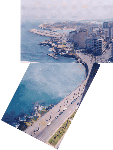
| Beirutís
coastline is a ribbon encoded with perfectly defined segments. A first
possible and arbitrary listing, North to the South, would give: Beirut
Riverís mouth, slaughterhouses, an industrial zone, a bus station, an international
harbor, a vast recovered land on the sea, a public disposal, a hotel that
carries the traces of Auguste Perret, the former Lebanese Handicraft building
transformed in a Thai / Moroccan style restaurant, a theater in difficulty,
two small fishing harbors of which an is drained, a coastal boulevard usually
called the corniche, an American University, various constructions, an
old lighthouse and a new one, a military bath (in fact there is also an
old and a new one), Chatila or Rawda cafe, a Luna Park with a grand revolving
wheel, a rock of the top of which jump the candidates to the suicide, and
to finish the unique sand beach of the city. |
| The
work of the workshop will consist in to define and study the "holes" of
this ribbon, the manner in which the city and the sea succeed in finding
a way towards each other through an apparently mastered coastline.
These holes that can be underground, aerial or simply in surface, they
can be expressed by physical devices, topography or social behaviors, and
will constitute the instruments that will allow releasing a new report
on the coastline and to initiate appropriation rituals. |
| "là
où la carte découpe, le récit traverse." Michel de
Certeau |
|
 |